Achham district
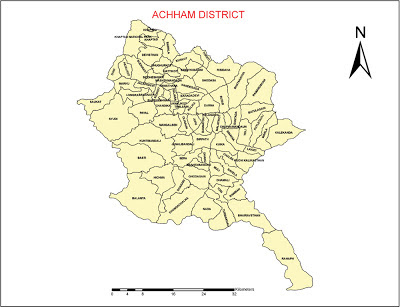
Achham district, a part of Seti zone, with Mangalsen as its headquarters, covers an area of 1,692 sq km(653.3 sq mi) and has a population of 257,477 (2011).
 |
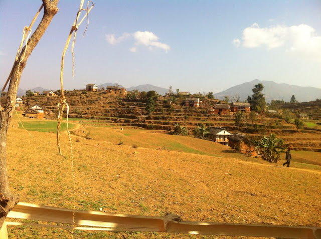
| A view of Sanfebajar, Achham (Cr: Trilochan Thapa) |
It is accessible by automobiles from Kathmandu and Nepalgunj via a national Highway. Achham is a beautiful place with various forts and natural resources.
We can stay in Achham at Sanfebagar, mangalsen and kamalbajar.
Location
Longitude: 810 7”- 810 35”
Latitude: 280 45”-290 22”
Area:1,692 km2 (653.3 sq mi)
headquarter: Mangalsen
Boundary
East: Dailekh and Kalikot
West: Doti,
North: Bajura and Bajhang,
South: Surkhet and Dailekh.
Sub-tropical,Mild-temperate,cool- temperate.
Temperature:-
Maximum: 30.00 °Centigrade
Maximum: 30.00 °Centigrade
Minimum: 1.00 °Centigrade
Rainfall 1790.8 ml.
Predominant culture
Nepali, Dotyali, Achhami.
Tourist attraction centers
Mangalsen, Jayagadh, Gajara, Ramaroshan, Binayak.
 |
| Baidhyanath Temple Achham |
 |
| Bayalpata Hospital Achham |
 |
| Our Culture,Our Pride |
 |
| Dhakari in Sunny day |
 |
| school with under construction Road |
 |
| Beautiful view of Ramaroshan |
Villages of Achham:
 |
| Mangalsen, Achham |
(Sources: Wikipedia, local newspapers and Photos by Dr. Roshan Raj Bista and Suresh Tamrakar )


I am happy to find this small piece of digital information about Achham.. This is really less yet appreciable in the context that many from here have reached to peak leaving no impression of their strength and power for the cause of Achham. Purna Rawal
ReplyDeleteThank You Purna Rawal G.
DeleteWhat nice web page, thanks web, i get a lot of information about far western.
ReplyDeleteWish keep continue published articels and local news
Thank You Puran G
Delete